
Destination Borden-Carleton
Destination Borden-Carleton
A lasting impression
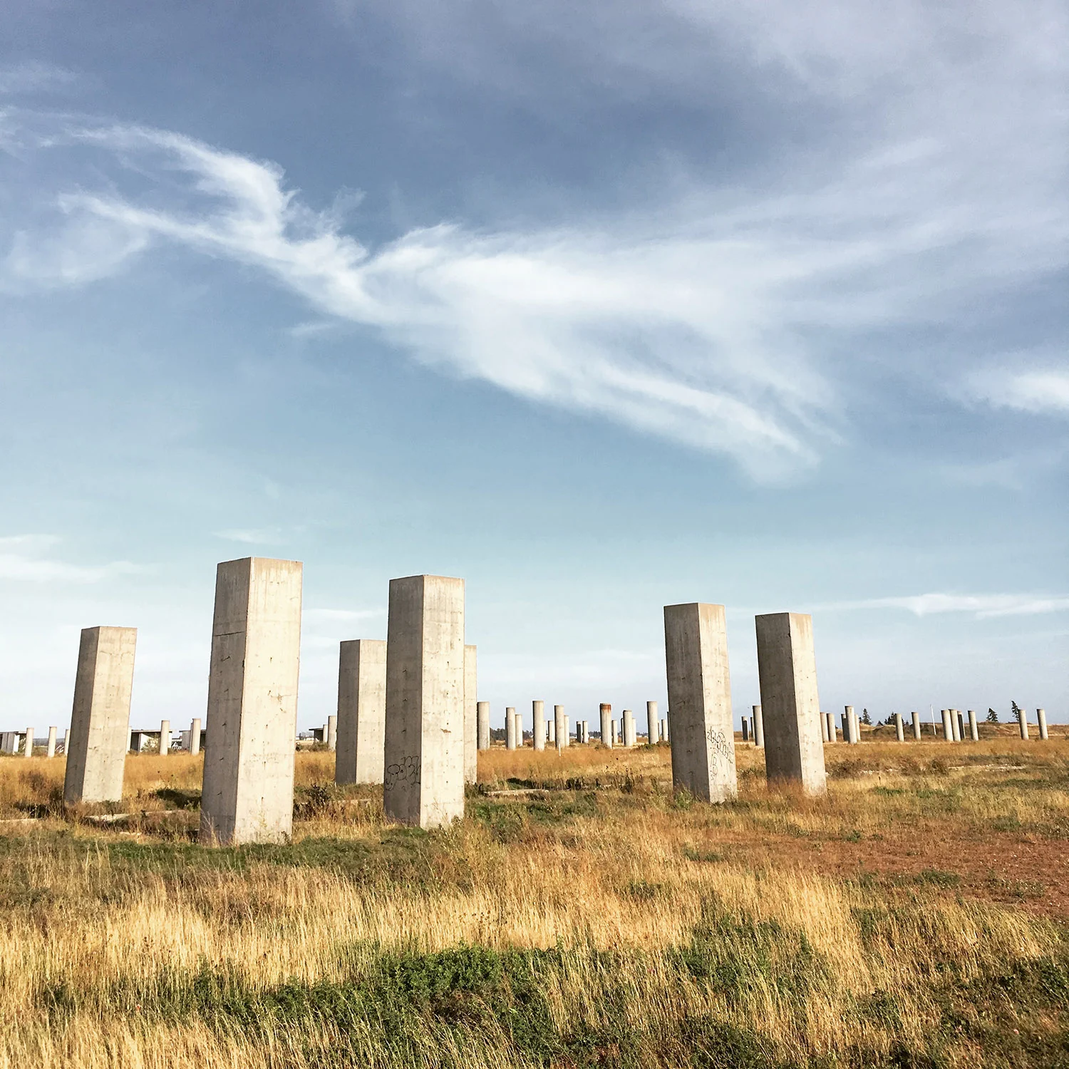
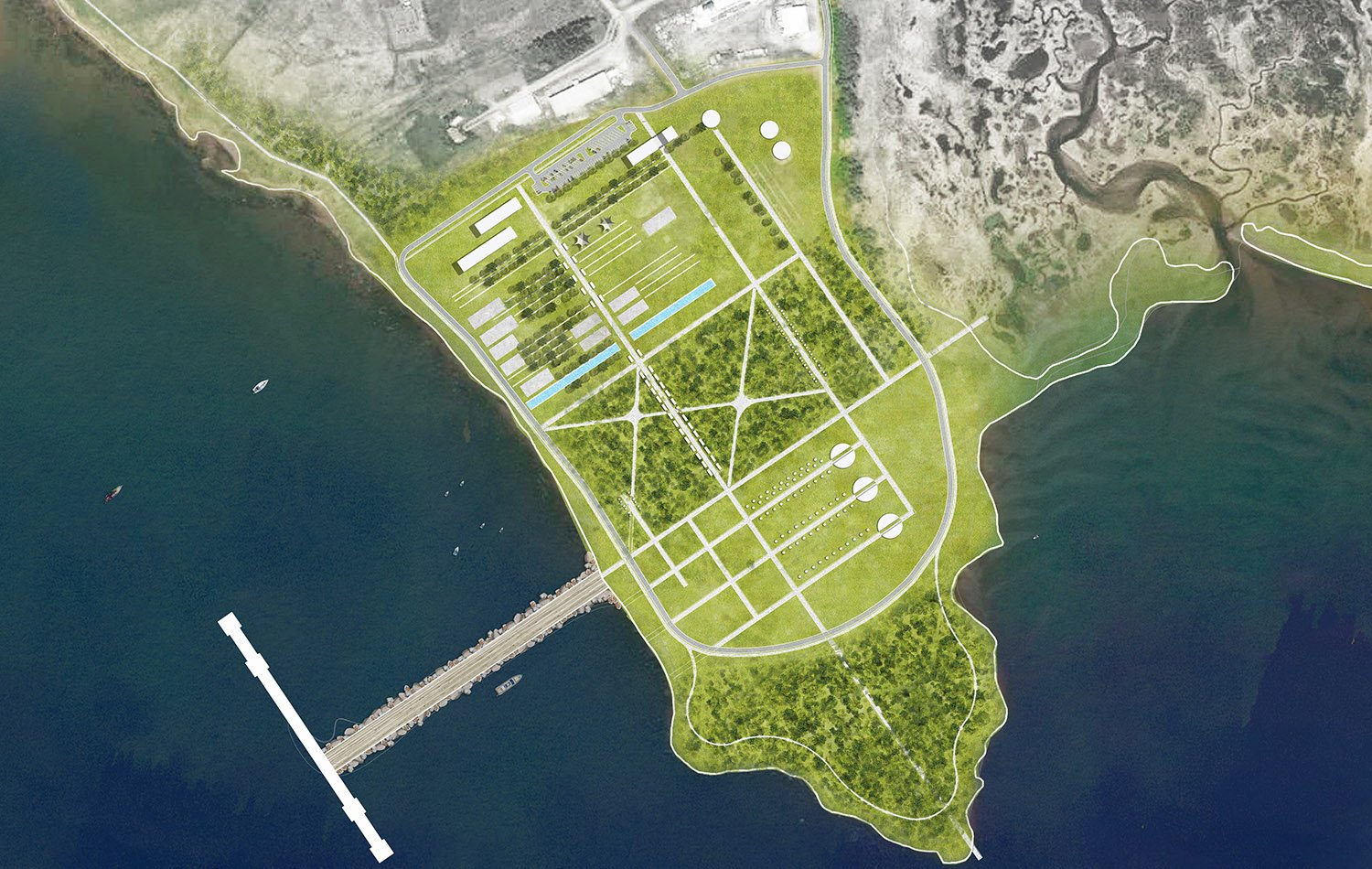
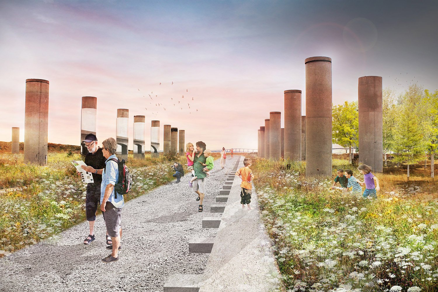
While Borden-Carleton is like many Atlantic towns experiencing drastic population decline, it is unique in its assets and circumstances. The story of Borden-Carleton is told through its long history as the connection point between Prince Edward Island and the mainland. For almost a century, the town functioned as the main port creating an economy surrounding ferry service and export. The construction of the Confederation Bridge in 1997 as a fixed link was a significant turning point for the community, removing the necessity of the port and its local workforce. To make matters worse, the SCDI Fabrication Yards (a 150-acre infrastructural post-industrial landscape where the Confederation Bridge was constructed) were locked and set aside with the promise of future redevelopment. Today, the impacts of not planning for, or with, the existing community is told through a drastic decline of 13% of its population over the past two decades.
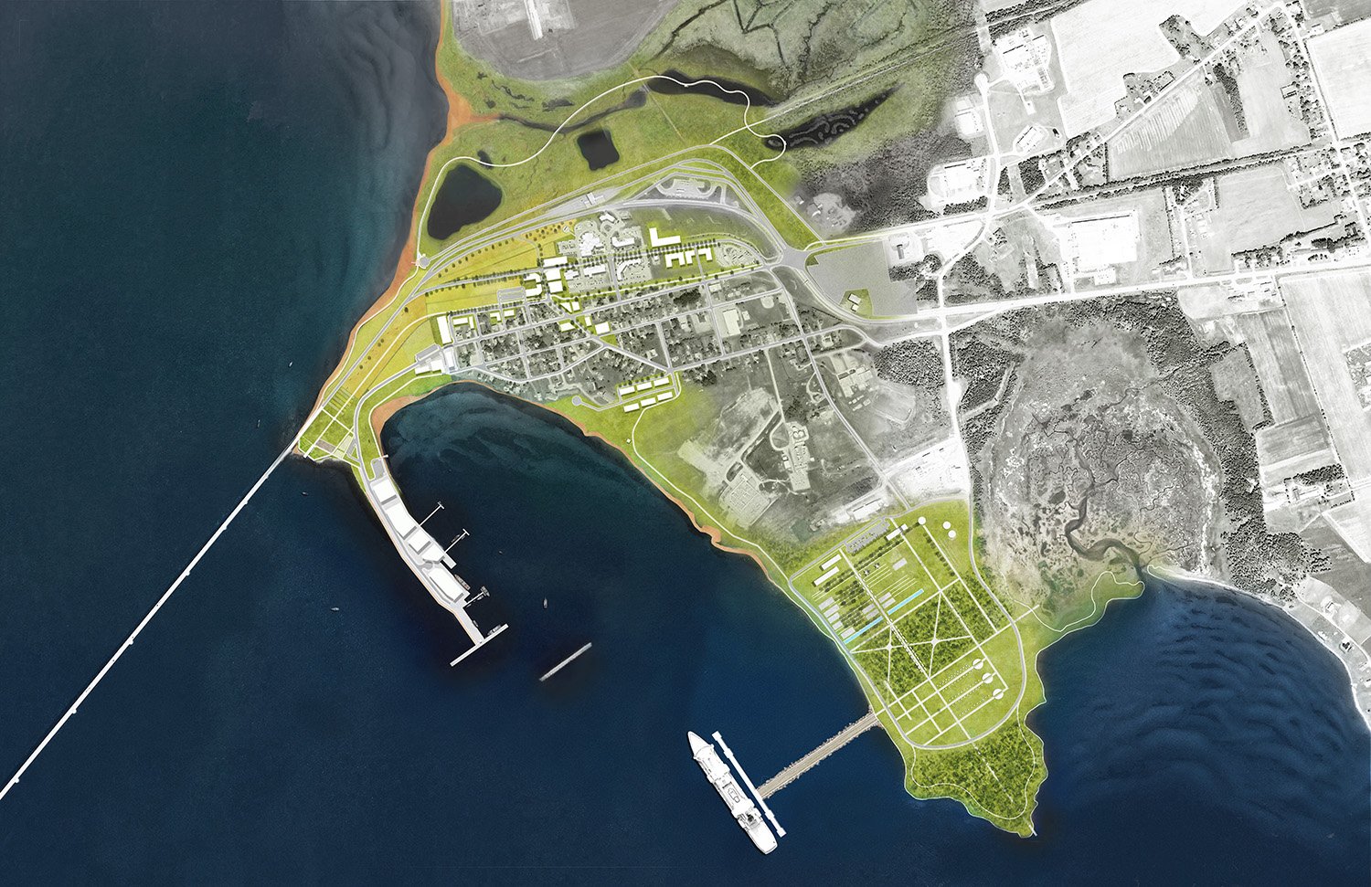
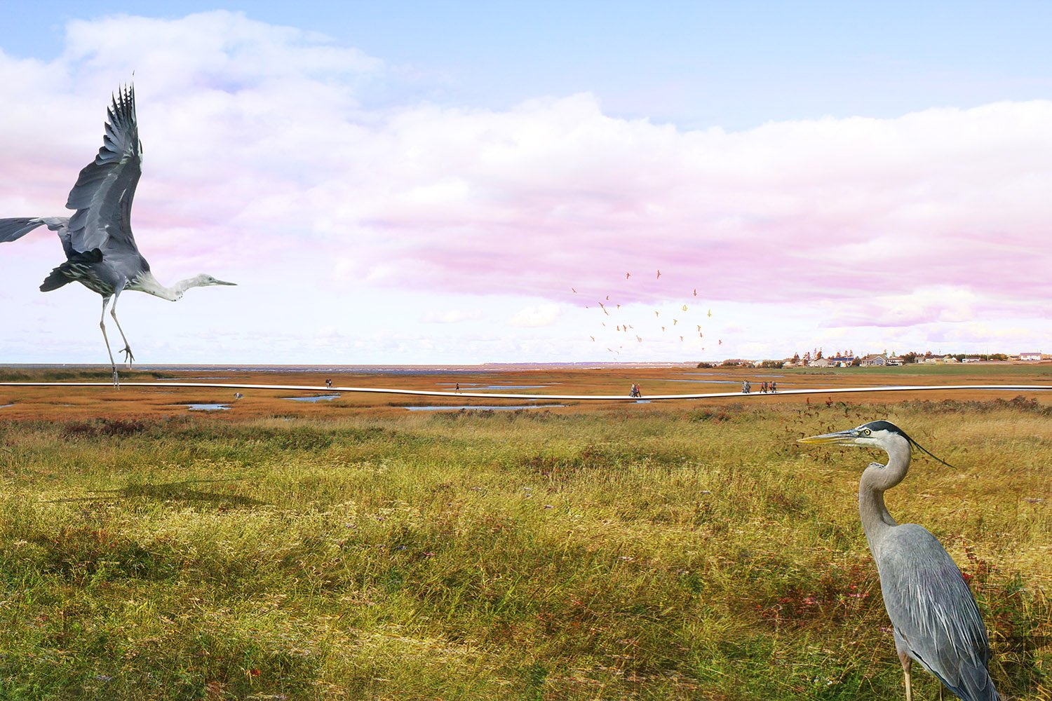
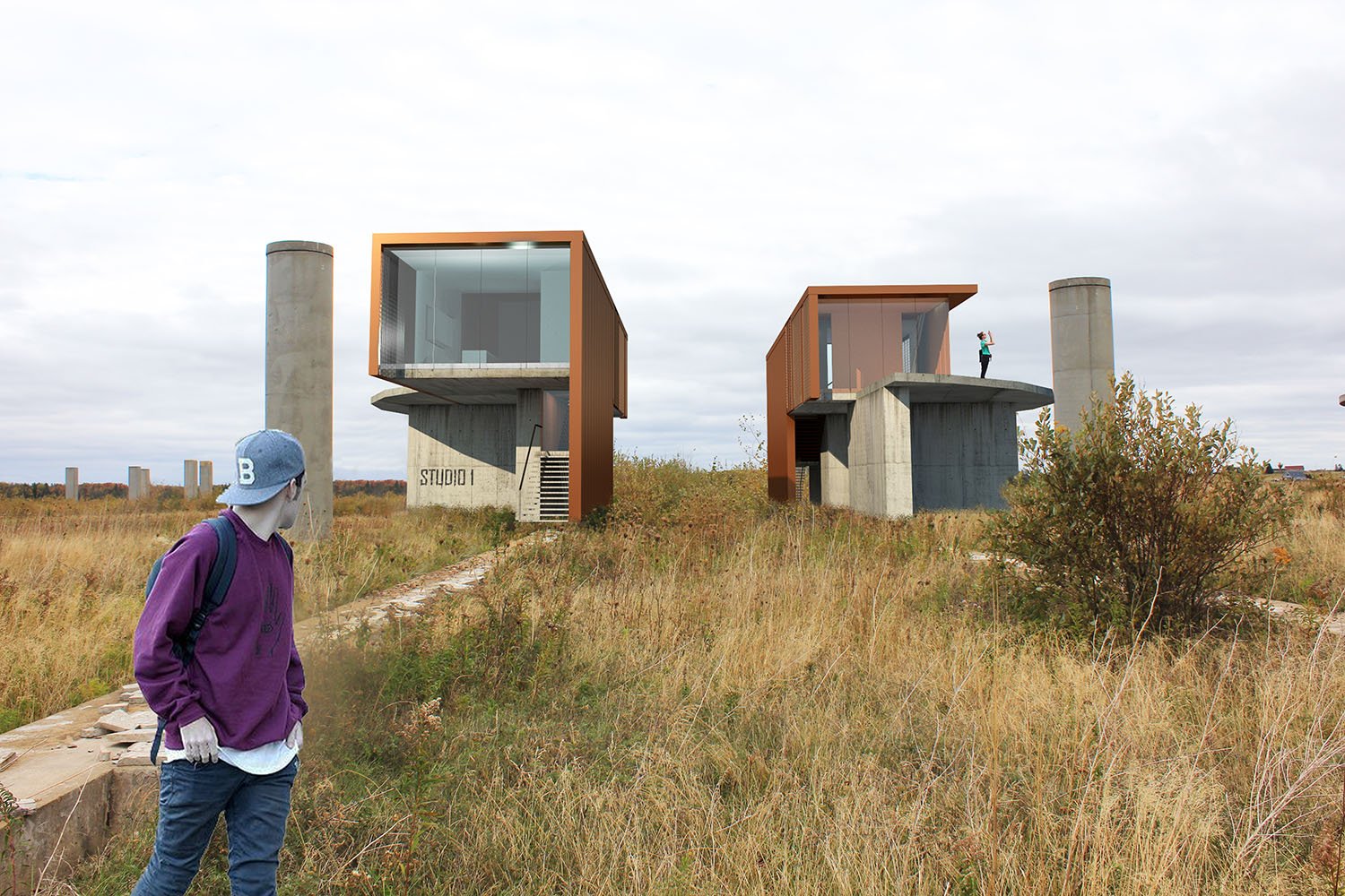
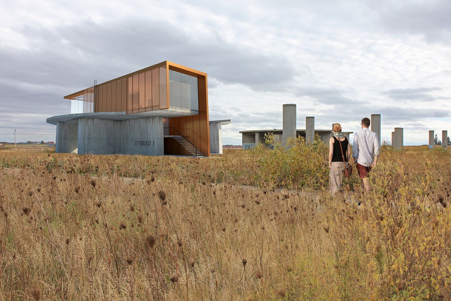
The planning process for Destination Borden-Carleton put the existing community as its top priority, driven by public engagement and involvement. Working collaboratively through community workshops, stakeholder interviews, and an oversight committee, we were able to understand the fascinating history of the place, while simultaneously completing an in-depth site assessment. When experiencing Borden-Carleton, it quickly becomes apparent that the town has all of the ingredients to become a successful tourism destination. The community has thousands of vehicles passing through daily, and unique assets and experiences that include the proximity to the Confederation Bridge, sandy beaches, extensive wetland marshes, beautiful sunsets, and the incredible, untapped potential of the Fabrication Yards Lands. The ultimate challenge was to convince the entire community that what they have always seen as a blight on their town, could be their most valuable asset moving into the future.
Destination Borden-Carleton is more than a tourism plan - it is a planning and spatial strategy for rural community growth and development. With tourism as the catalyst, an overall strategy is distilled into smaller and more attainable spatial plans and projects that will each independently contribute to fostering economic growth and community well-being. Each project feeds into the main goal of increasing employment opportunity through tourism attraction, while also creating places that contribute to the overall strength of the local community.
Status
Completed 2018
Our Role
Planning
Client
Borden-Carleton Development Corporation
Location
Borden-Carleton, Prince Edward Island
Awards
2018 - Canadian Institute of Planners: Award for Planning Excellence, Rural/Small Town Planning
All images ©Fathom Studio

The vision for the new net-zero facility for the Under One Sky A•wit•gati Longhouse & Culture Centre in Fredericton is to be a vibrant, iconic, community-centered facility that can accommodate a diverse, and urgently needed array of programming for the urban Indigenous community at all stages of life. Celebrating Indigenous knowledge throughout the building’s design is crucial to achieve this vision. The new Friendship Centre is designed as a collection of bisymetrical volumes derived from the sections of a turtle shell, each pod connected by a glazed passageway. The interconnected spaces allow for intergenerational knowledge to be shared as they would be in a longhouse. The building pods are gathered in a semi-circle, each one connected to the centre of an outdoor gathering circle and ceremonial fire.
Each pod is assigned one of the Seven Sacred Teachings, tying the building together while giving each space a distinct representational identity that corresponds to its use. The earth, wind, fire, and water gardens surround the pods and are designed and located based on the medicine wheel creating visual and physical extensions from the building, encou aging outdoor social and cultural activities.
Status
ongoing
Type
Architecture, landscape architecture, planning, wayfinding, brand
Client
Under One Sky Friendship Centre
Location
Fredericton, New Brunswick

Diamond Bailey Healing Centre is a new emergency transitional housing centre operated by the Mi’kmaw Native Friendship Centre in Halifax, NS. It is named after those who dedicated their entire lives to harm reduction within the urban Indigenous community. The design of the building strays from a standard institutional layout to incorporate a more diverse method of support that is based on the needs of each individual. The housing is phased from shared bunk rooms to smaller individual dorm rooms and then to bachelor apartments to help with the transition into longer term housing. In addition, the process of smudging was considered when designing the building’s systems in order to allow for this sacred ceremony to happen throughout the building. Each space features design elements that are both inspired by and celebrate Mi’kmaw culture. It was critical for the project to be rooted in Indigenous principles while meeting the functional needs of the facility. Aside from the housing component of the building, there is also extensive storage space for potential donations and multipurpose program space to allow for smaller scale events and workshops for the local community.
STATUS
Completed 2023
TYPE
Architecture, Landscape Architecture, Planning
CLIENT
Mi’kmaw Native Friendship Centre
LOCATION
Halifax, Nova Scotia
AWARDS
2024 - Atlantic Architectural Design Excellence Awards - Award of Merit
2023 - Halifax Urban Design Award - Award of Excellence for Housing Solutions
Revitalizing and conserving our heritage
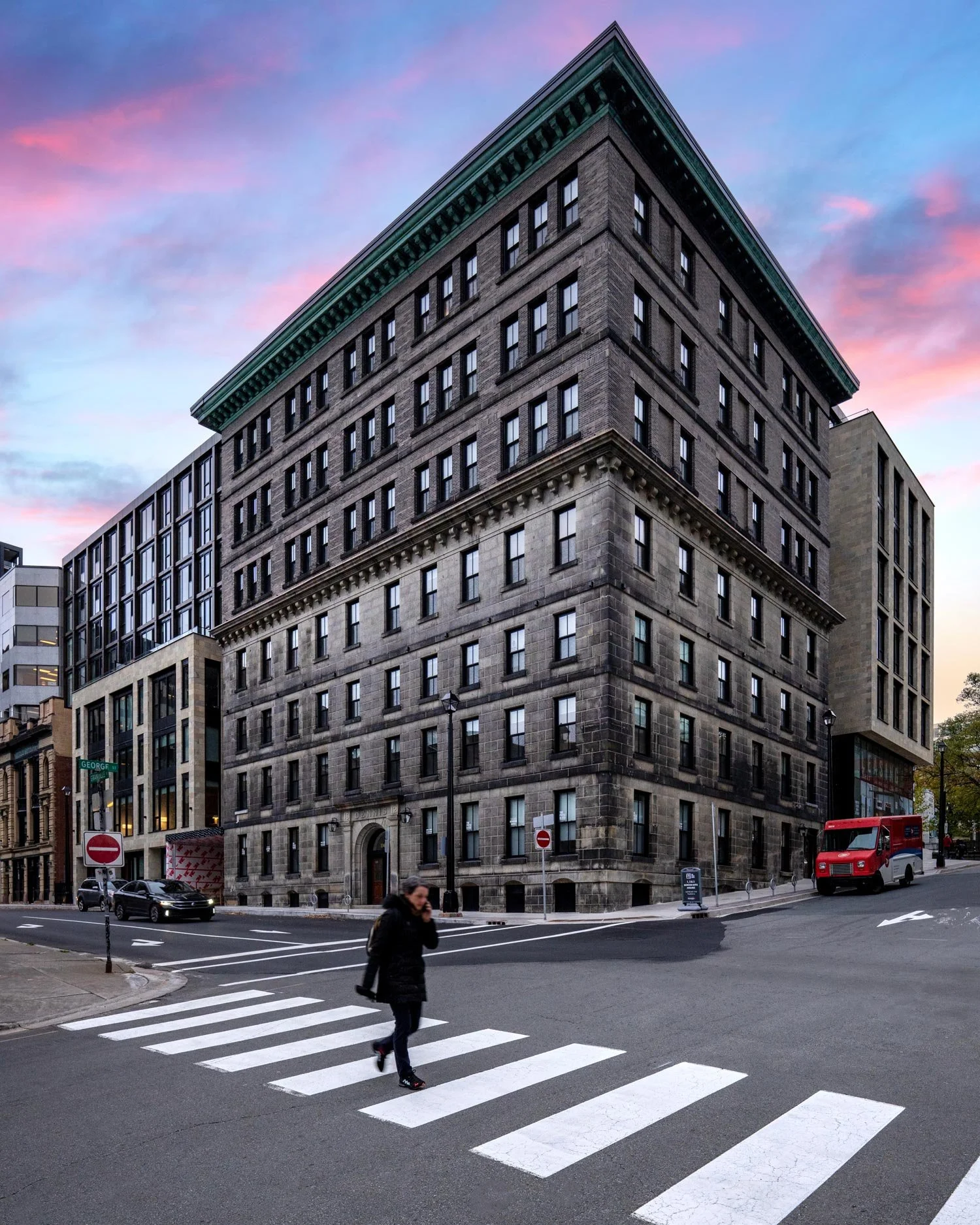
Located in Downtown Halifax between the Grand Parade and Province House, this project illustrates the value of mixed-use urban developments that integrate heritage, retail streets, and residential units. Following a successful Design Competition submission from Fathom Studio in December 2019, the project was awarded to Dexel Developments by the Province of Nova Scotia, and Fathom Studio was hired as the Architect of Record.
This project contributes to a revitalized downtown that addresses the past, present, and future of the site by conserving two prominent heritage buildings: the Kenny-Dennis Building (1863) and the Acadian Recorder (1900). The contemporary design revitalizes a prominent site, mitigates challenging site conditions, and reinstates the corner of Barrington and George as a significant commercial landmark.
Our approach to creating quality human-scale streets is reflected by maintaining the rhythm of the existing commercial buildings on Barrington street. The project is a holistic addition to the city that uses a simple, clear design language that provides a restrained backdrop for prominent heritage elements. The comprehensive development takes a minimalist approach in building massing and materiality, and reinterprets the site without interfering with its long standing character.
Status
Under Construction
Our Role
Architecture, Planning, Interpretive Planning
Client
Dexel Developments
Location
Halifax, Nova Scotia
Awards
2026
Atlantic Architectural Design Excellence Awards - Award of Excellence

Fathom was commissioned by the Charlottetown Area Development Corporation and the City of Charlottetown to redevelop Roundhouse Park in the Downtown Waterfront District with a permanent outdoor skating rink.
The design celebrates and interprets the form of the CN rail roundhouse building and infrastructure that once occupied the site with contemporary materials and assemblies. The design integrates plazas, warming shelters, washrooms, public art installations, all with careful consideration of lighting, sound, programming, and municipal operations and maintenance in all four seasons. The project also addresses the heavily polluted site by raising the elevation of the rink and capping contaminated soils and debris instead of removing and disposing material at an off-site facility.
When built, it will become a destination for locals and visitors alike that supports the adjacent Founders Hall Market and brings new life to the east end of the waterfront.
Status
2021 (Concept Design)
Our Role
Landscape Architecture
Client
Charlottetown Area Development Corporation
Location
Charlottetown, PEI

Creating the Neighbourhood
Located on the corner of Pepperell St. and Robie St in Halifax this mixed-use building transitions from the large-scale building context of Quinpool Road into what are primarily single-family residential neighbourhoods to the south and west. The primary density is located in the northeastern corner of the site to allow for a southern exposure to the internal courtyard.
The building steps down to walk-up townhouse units along the two bordering residential streets to integrate and activate the neighbourhood streetscape.
The corner has a double-height commercial space to create a neighbourhood anchor and an interesting corner address to the building. The use of human-scaled materials, formal articulation, and strategic massing result in a building that reinforces and improves the neighbourhood's character.
Fathom was responsible for planning approval, architectural design, interior design, brand development, wayfinding and signage.
Status
Completed 2022
Our Role
Architecture, landscape architecture, planning, wayfinding
Client
Dexel Developments
Location
Halifax, Nova Scotia
Building Type
Mixed-use
Awards
2024 - Atlantic Architectural Design Excellence Awards - Award of Merit
2023 - Halifax Urban Design Award - Award of Excellence for Urban Architecture
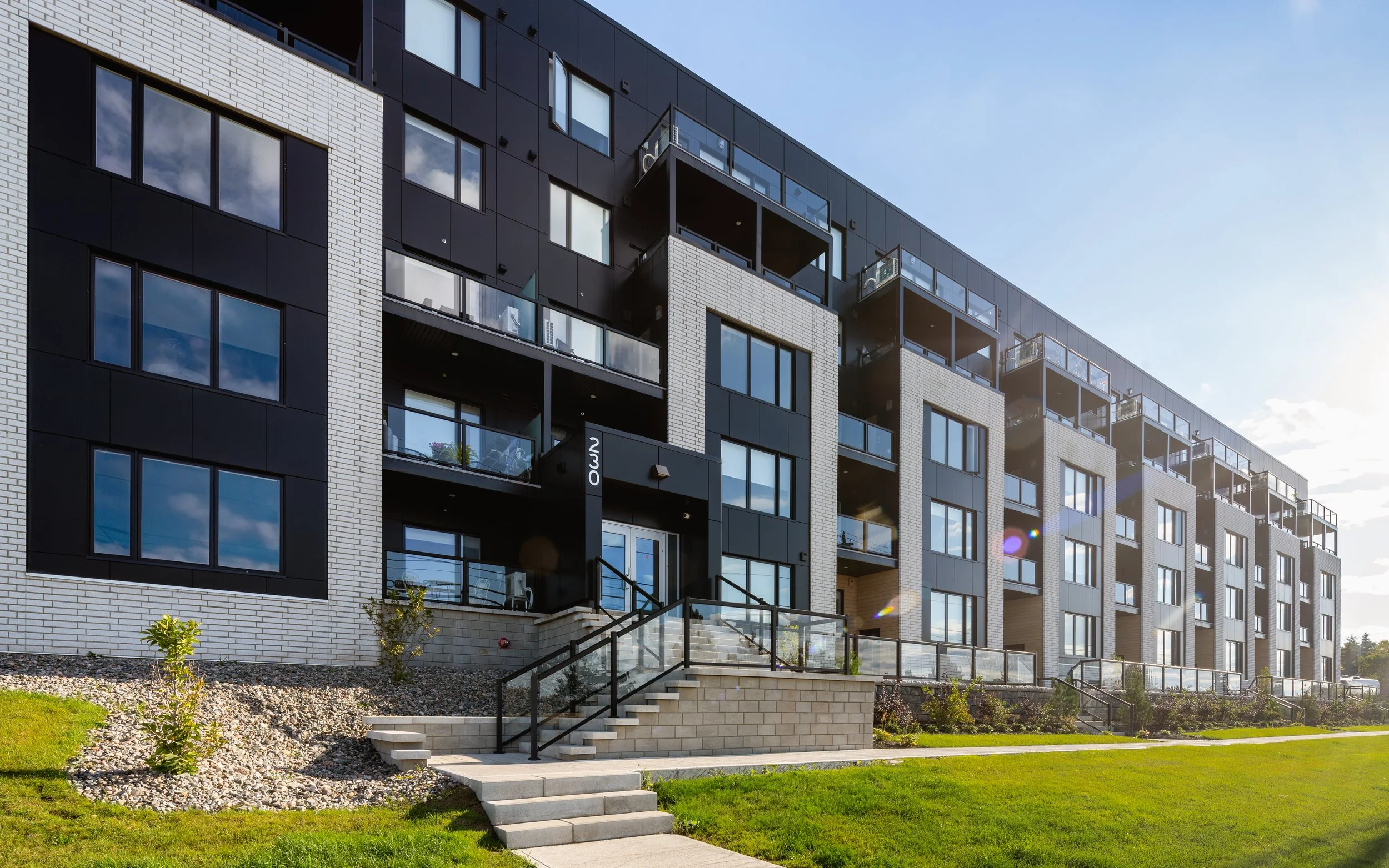
Fathom completed the planning and design for The Tides, a 5-storey, 73-unit building in Riverview, New Brunswick. This project, situated on a complex site with significant grade changes, presented challenges that Fathom’s architectural and landscape teams overcame by strategically integrating underground parking and thoughtful site grading.
The building was one of the first in the province to use wood-frame construction, which was showcased through sustainable wood details inside, contrasted with grey and darker finishes to enhance the wood’s natural beauty. Blue accents in the amenity spaces give a subtle nod to the nearby Petitcodiac River. Fathom’s planning team also managed the site’s rezoning, ensuring the project harmonized with its surroundings while addressing flood risks from the river.
Status
Completed 2023
Our Role
Planning, architecture
Client
Thrive Properties
Location
Riverview, New Brunswick
Building Type
Residential

The Oak, is the first of eight buildings in the Twin Oaks Drive development. Located in Moncton, this 6-storey residential building emphasizes sustainability and structural efficiency. The project encompassed the creation of a comprehensive master development plan, compliant with Moncton’s new Development Charges Bylaw. The studio navigated the rezoning process and oversaw multiple technical assessments, including a traffic impact study, shade and microclimate studies, and a stormwater management plan that features a series of ponds in the newly developed park area. This park manages stormwater and serves as a central amenity for residents.
The Oak sets the architectural tone for the entire development, all with underground parking and direct access to the active transportation trail connecting to major Moncton destinations. The building’s exterior utilizes contrasting cladding elements to break down its massing, with lighter ceramic panels creating a human-scale visual rhythm. Wood details are incorporated in balconies and unit entries, contributing warmth and a connection to the building’s sustainable construction.
Status
Completed 2024
Our Role
Planning, architecture
Client
Thrive Properties
Location
Moncton, New Brunswick
Building Type
Residential

The Shubenacadie Operations Centre is a building that combines two departments with three divisions under one roof, located along Nova Scotia Highway 2 and facing the Shubenacadie River. The design of the building focuses on utilizing the natural setting to enhance the working environment and minimize site impact. The building features a flat roof, allowing for equipment, lab ventilation and PV installation. The centre also focuses on natural light, with individual offices and work spaces kept along the perimeter of the building to maximize access to natural light. Centralized common rooms and cross-circulation corridors allow natural light to penetrate the floor plate from both sides, preventing deep and narrow office sections. The operations centre is designed to meet LEED or Net Zero design standards and has a low carbon footprint thanks to the use of PV, efficient mechanical ventilation systems, and a Biomass boiler. Additionally, the building envelope is designed as an efficient rainscreen wall assembly using outboard mineral wool insulation and high-performance glazing.
Status
Ongoing
Our Role
Architecture, landscape architecture, planning
Client
Province of Nova Scotia: Department of Natural Resources
Location
Shubenacadie, Nova Scotia

Rooted in a deep understanding of the town’s changing demographics, Fathom crafted a space that embodies accessibility, versatility, and community vibrancy.
Inspired by local architecture, the design prioritizes flexibility, allowing the market to organically grow, shift, and adapt over time. Fathom’s commitment to sustainability is evident in the careful consideration of materiality and form, ensuring ample natural light and air circulation.
The interior programming seamlessly integrates with the exterior, enabling the market to adapt seasonally, host food trucks, and accommodate performances. This dynamic synergy aligns with the town’s evolving needs, creating a robust and energetic marketplace.
Outdoor walkways and gardens further enhance the welcoming atmosphere, naturalizing the space and fostering a sense of community. The New Glasgow Farmer’s Market, as reimagined by Fathom, transcends traditional market concepts, emerging as a living, breathing hub that reflects and amplifies the spirit of New Glasgow. The community is now seeking funding.
Status
Schematic Design - 2023
Our Role
Architecture, landscape architecture, planning
Client
Town of New Glasgow
Location
New Glasgow, Nova Scotia

Storyboard on the landscape
As sesquicentennial celebrations unfold, it is important not to overlook Canada’s pre-Confederation and first nations heritage. This experiential design undertaking is aimed at strengthening ties between the Canadian Government and the Métis Nation—Saskatchewan.
At the heart of this history is a land dispute—the source of inspiration for our core concept. Two opposing methods of landholding: a thoughtful linear and river-oriented allotment by a semi-nomadic turned agrarian people versus an unnatural grid-based system imposed on one nation by another. Herein lies a testimony of a land that follows from non-issue to conflict, through an entente to a formal collaboration between a First Nation and a government.
A National Historic Site of Canada since 1923, this 955 hectare property is an impressive landscape in a setting of aspen forest and remnant fescue prairie. The focus for our project is Lot 47, the location of the once thriving village of Batoche. Our design seeks to tell the story of this place, considered the heart of the Métis nation. The Métis are descendants of those born of indigenous and European peoples.
Rather than imposing numerous and frequent insertions, we unite this expansive cultural landscape through the delicate placement of four conspicuous elements. Minimal intervention and a light footprint were key goals. For example, a simple mowed/burned strip that reinforces the linearity and direction of the river lot. Structures are raised up on piles to reduce impact on this archaeologically sensitive site. Robust materials—weathering and galvanized steel, cedar, and stone—minimize maintenance and evoke themes of permanence. Efficiency pervades the details–best demonstrated by innovative batten joinery developed to significantly reduce the size and quantity of fasteners.
The distinct seigneurial river lot land division plays a role throughout, from the spacing of Saskatoon berry rows in the to the organization of the overall site. The wooden panel system—a structure to provide support, a trope to represent the river lots—is also rooted in another reference to Métis culture: the weave of the ceinture fléchée sash. The interpretation supports a sense of pride by honouring both the pre- and post-battle story. Together with modern building forms and materials, the conviction of a thriving Métis culture is reinforced.
As a team of multiple professions, the synthesis of method, process, and workflow of our colleagues enriches our designers. For example, our architects and landscape architects think not only of the natural/built environment, but consider interpretation and graphic details as part of their interdisciplinary design process. This is an account of disciplines collaborating to use the landscape not merely as a setting, but rather as a lead character.
Parks Canada’s goal is for an architecturally interesting, one-of-a-kind, and interactive design that incorporates historically significant themes and activities of Batoche. Parks wished to use this project as a bridge to allow a landscape scarred by resistance to tell a story of a thriving culture, to create a destination, and to reestablish ties. Through design, we hope to honour the Métis story and to improve cultural relations.
Status
Completed 2016
Our Role
Architecture, landscape architecture, interpretive planning & design
Client
Batoche National Historic Site, Parks Canada
Location
Batoche, Saskatchewan
Awards
2017
Azure AZ Awards - Experiential Graphic Design, People's Choice
Azure AZ Awards - Experiential Graphic Design, Award of Merit
2017
Society of Experiential Graphic Designers (SEGD) - Global Design Awards, Finalist

The East Coast Trail (ECT) is a 300+ kilometre wilderness trail along Newfoundland and Labrador’s Avalon Peninsula. Snaking along the coast from community to community, the trail organization asked us to develop a sign system to guide hikers from the highway to the trailhead, to make it easier for existing hikers to find their way, and also to make the trail more visible to potential new audiences. The sign system also helps guide long-distance hikers from one segment of trail to another, as they pass through villages and other urban areas.
The twelve signs in the system identify and direct hikers, but also provide space for donor and sponsor recognition, as well as regulatory information and trail notices. The project included planning and design, as well as sign programming for certain trails, a phasing plan and budget for a rollout of the sign system, and complete tender documentation.
To accompany the wayfinding system, we also created a series of 34 maps of the trail and local points of interest. The maps focus on information critical to hikers including access points, topography, distance, time estimates, difficulty and roadways.
Status
Design 2016–2018
Completed 2022
Our Role
Wayfinding
Client
East Coast Trail Association
Location
Avalon Peninsula, Newfoundland & Labrador

Marking Canada’s sesquicentennial (150th birthday), this project marks a turning point in the history of the Shannon Park area in Dartmouth, a critical moment in the site’s transformation from former military residences to a new vibrant community.
The project includes a new trail through the future development area to Norris Point, leading to a lookout providing unparalleled views of the Halifax Harbour, MacKay Bridge, Bedford Basin, and Narrows. Lookout visitors are treated to an interpretation of the harbour—central to every possible history of this city.
We completed concept and detailed designs for the project, including a phasing plan for how the trail route could change over time as the Shannon Park site is developed. The trail route was initially mapped using GPS technology, and custom details were developed for the lookout deck, metal handrail, and all signage.
Status
Completed 2017
Our Role
landscape architecture, wayfinding, interpretive
Client
Canada Lands Company
Location
Halifax, Nova Scotia

An integrated landscape
Building and Site re-design to better handle flow of traffic and improve visitor experience throughout the campground and greater area.
The new design creates streamlined circulation routes; dedicated entry/exit roads, passing lanes, and an intersection re-designed for clear traffic flow and pedestrian safety. Parking capacity was increased and is accessible from multiple points, providing better access for campers, trail users, and visitors to the Cavendish area. All these features are connected into a multi-function visitor centre/entry kiosk.
The Visitor Centre acts as a gateway to the existing campground, and serves as a trip planning centre for visitors in the area. The building’s massing, design, and material evoke traditional farmstead architecture, and takes cues from the local landscape. The building responds to both staff and visitor needs by separating public uses (trip planning, camp store, washrooms, firewood storage) from administrative uses (staff areas, ticket window, equipment storage) and organizing these functions within three gable-roof structures grouped around a landscaped courtyard.
The programmatic interplay is well balanced around the courtyard with integrated landscape features, site services and signage, and addresses all public access points. It was designed using sustainable and local materials to uphold Parks Canada’s approach to sustainable design.
Status
2016 design
2017 construction
Our Role
Architecture, Landscape Architecture
Client
Parks Canada
Location
Cavendish, Prince Edward Island

New potential in Summerside, PEI
We were retained to prepare an urban development strategy for downtown Summerside linking its downtown to a new waterfront district. The plan imagines a new Holland College urban campus, a large waterfront park, public open spaces along the waterfront and a shared street linking downtown to the waterfront.
Status
Completed 2016
Our Role
urban design and planning, landscape architecture, architecture
Client
Town of Summerside
Location
Summerside, Prince Edward Island
Awards
2016 - Atlantic Planning Institute - Award of Planning Excellence, Physical Plan & Design

Framing the view
Terra Nova is bisected by the Trans Canada highway drivers currently enter the park with little fanfare. Ekistics was commissioned by Terra Nova National Park to develop concepts to revitalize the existing park entrance points to create a sense of arrival. The design for each entrance builds on the concept of ‘the frame’; using landscape design, architecture and interpretive features to set up a curated series of thresholds and views that begin before the visitor even exits their vehicle. Once on foot, the visitor is greeted by a view framed by the architecture itself.
Following the schematic design in phase 1, the trail design was determined on-site and utilizes existing topography and clear areas and is designed to limit grade changes and tree removal, switchbacks are used to minimize grading while keeping the trail accessible and the use of local materials minimizes the impact on the forest. Detailed design drawings were submitted in 2 phases at 66% and 100%, cost estimates presented with the submissions. A tender package including all details and technical specification were also included.
Status
2016 - design
2017 - construction
Our Role
landscape architecture, architecture, interpretive, & wayfinding
Client
Terra Nova National Park, Parks Canada
Location
Terra Nova, Newfoundland

On the edge of everywhere
The Town of Yarmouth positions itself “on the edge of everywhere”, at the south-western tip of Nova Scotia. Yarmouth asked us to unify wayfinding and signage for the entire town, integrating their newly implemented brand with signs for visitors and residents, including: directional signs, urban trail signs, information kiosks, signs to help guests self-guide around the historic houses district, and banners to make the streetscape more colourful.
In an effort to reduce sign clutter, not only did the program include the implementation of a new system, but also included a 'designing' campaign to remove outdated and redundant signs. Thirteen sign types were located at over 200 positions in the town and were installed the summer and fall of 2016.
Status
Completed 2016
Our Role
Branding, Wayfinding
Client
Town of Yarmouth
Location
Yarmouth, Nova Scotia

Coastal living
Fathom was hired to master plan an ocean-front property that has been in the MacLeod family for decades. It was critical to design units that capitalized on ocean views and created a variety of unit types that appealed to giving them access and lead people from all walks of life to this beautiful part of our province.
Our primary goal was to achieve the desired development density while maintaining the natural character of the site. We approached the challenge by looking for a simple solution that would maximize the ocean and golf course views while maintaining the privacy of the individual units. Our master plan was developed simultaneously with unit types to ensure that the design worked at all scales, and maintained our core principle of respecting the property.
Having planning, architecture, landscape architecture, and civil engineering all working together with the client allowed us to create an effective master plan that addressed all of the design constraints and opportunities the site presented.
Status
Planning 2015–2017
Our Role
Planning, architecture, landscape
Client
MacLeod Family
Location
Inverness County, Nova Scotia

Stories by the Sea
The Town of Marystown, on Newfoundland’s Burin Peninsula, was home to one of the province’s most unusual cultural sites: Jerome Walsh’s Museum. Created by the fisherman-turned-storyteller Jerome Walsh, the museum was a converted fishing shed, home to his eclectic collection of memorabilia.
After his death, however, the museum fell on hard times, and the tiny oceanside structure was in danger of falling into the sea. The challenge was to honour Jerome’s legacy and continue his work, without the larger-than-life personality of Jerome himself being present.
Our solution was to design a new flexible space for programming and interpretation, injecting Jerome’s love of the fishing life and passion for storytelling into a modern, signature site on beautiful Little Bay. With only a tiny site to work with, every square foot had to work as both public area and interpretive space, with support for both live events and conventional exhibits.
We also worked with the town’s other museum, the Marystown Heritage Museum, to upgrade their visitor experience and build links between the town’s two foremost cultural sites.
We opted for a design that referenced Jerome and his museum rather than reconstructing the existing building. The result was a conceptual plan that drew on the skills of our architecture, landscape architecture and interpretive design teams to develop a vision for a must-see attraction.
Status
2016-17 design
Our Role
architecture, landscape, exhibition strategy
Client
Marystown Heritage Museum
Location
Marystown, Newfoundland
Pjila'si - Welcome
Working with the Mi’kmaq community, Fathom is creating created the new home of the Mi'kmaw Native Friendship Centre (MNFC). This project took shape through collaboration and consultation with the Friendship Centre leadership, staff, advisors and community members. We had the honour of being invited to the Membertou First Nations in Cape Breton to conduct research, take part in a sweat, and engage in extensive conversation with elders from the Membertou and Eskasoni nations.
Ultimately, this project is the product of extensive listening, learning and doing our best to understand and interpret stories and cultural nuances. The MNFC has served as a gathering place for Halifax’s urban Indigenous community for more than 45 years, providing space for social services and programs and space to celebrate Indigenous culture. The new building, proposed for the corner of Gottingen and Rainnie Drive, will provide much-needed space for additional programming and social services to Halifax’s Indigenous community.
Status
Ongoing - Anticipated 2026
Type
Architecture, Landscape Architecture, Planning, Branding
Client
Mi’kmaw Native Friendship Centre
Location
Halifax, Nova Scotia